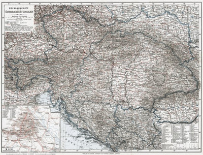
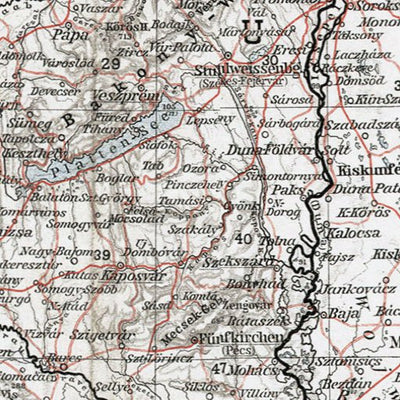
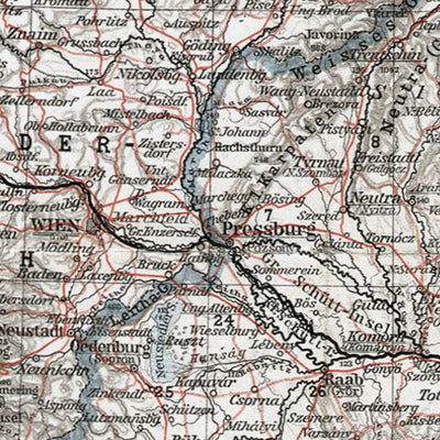
Railway Map of Austria-Hungary in 1910
$2.99 USD
Eisenbahnkarte von Österreich-Ungarn. A part of the historical map collection of Discus Media Group. Originally produced by Wagner&Debes, Leipzig, Germany. Digitally restored. Map scale 1:2,750,000. Includes map inset: Wien Verkehrskarte - map of the Vienna transportation, including railway...
Geographic area:
Category:
Historical
Size:
11.07MB
Publication:
1910
Language:
German
Map bounds
Check nearby mapsWhat you get with Avenza Maps

Reliable mapping tools
Record GPS tracks, add placemarks, add photos, measure distances, and much more.

Locate yourself with GPS
Avenza Maps offline GPS app on your mobile device can locate you on any map, without WiFi or network connectivity.

The best maps by the best publishers
Download professionally curated digital maps on the Avenza Map Store from the best-renowned publishers.