Amsterdam City Map, 1927 (1928)
- City Tours
$2.99 USD
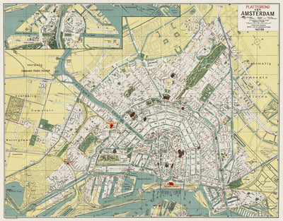
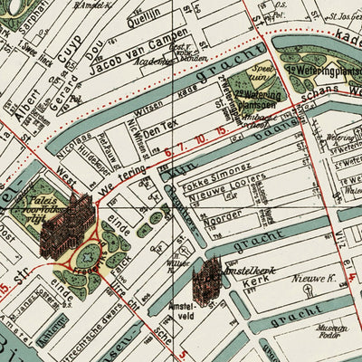
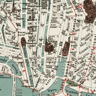
Plattegrond van Amsterdam. Detailed historical map of Amsterdam in 1927. The map covers entire built-up city area with neighboring suburbs. All the streets with their names are given with selected block corner house numbers. Public transport network in detail: electric and steam tramways, buses, ...
Geographic area:
Category:
Tourist
Size:
51.22MB
Publication:
1927
Language:
Dutch
Map bounds
Check nearby mapsWhat you get with Avenza Maps

Reliable mapping tools
Record GPS tracks, add placemarks, add photos, measure distances, and much more.

Locate yourself with GPS
Avenza Maps offline GPS app on your mobile device can locate you on any map, without WiFi or network connectivity.

The best maps by the best publishers
Download professionally curated digital maps on the Avenza Map Store from the best-renowned publishers.