

Northwestern United States & Canadian Provinces 1941
$4.99 USD
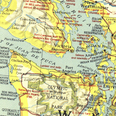
The map of Northwestern United States and Neighboring Canadian Provinces appeared in National Geographic Magazine in June of 1941 and focused on the states of Washington, Oregon, Idaho, Montana, and Wyoming, and the southern portion of the provinces of British Columbia, Alberta, and Saskatchewan....
Geographic area:
Category:
Educational
Size:
61.42MB
Publication:
1941
Language:
English
Map bounds
Check nearby mapsWhat you get with Avenza Maps

Reliable mapping tools
Record GPS tracks, add placemarks, add photos, measure distances, and much more.

Locate yourself with GPS
Avenza Maps offline GPS app on your mobile device can locate you on any map, without WiFi or network connectivity.

The best maps by the best publishers
Download professionally curated digital maps on the Avenza Map Store from the best-renowned publishers.