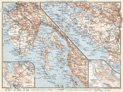
Istria and Dalmatian coast at Bossoglina (Marina) map, northern part, 1929
$0.99 USD
Historical map of Istria and the Dalmatian coast at Bossoglina with Šibenik and vicinity from 1929, in Croatia, then in Yugoslavia, produced by Wagner & Debes, at the scale of 1:1,000,000. Includes inset(s) at scale(s) of 1:30,000, 1:250,000. Digitally restored. A part of the Discus Media 190...
Geographic area:
Category:
Historical
Size:
4.8MB
Publication:
1929
Language:
Italian
Map bounds
Check nearby mapsWhat you get with Avenza Maps

Reliable mapping tools
Record GPS tracks, add placemarks, add photos, measure distances, and much more.

Locate yourself with GPS
Avenza Maps offline GPS app on your mobile device can locate you on any map, without WiFi or network connectivity.

The best maps by the best publishers
Download professionally curated digital maps on the Avenza Map Store from the best-renowned publishers.