
Brussels And Suburbs Plan, 1922. Plan de Bruxelles et Fabourgs
$2.99 USD
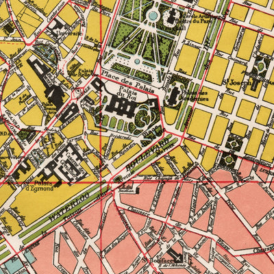
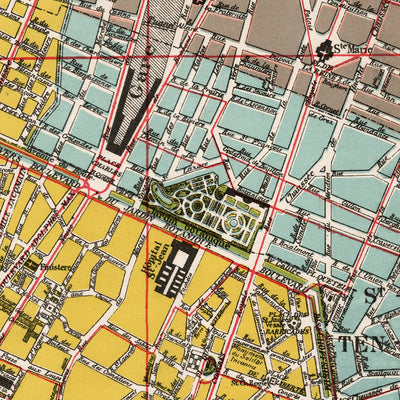
Detailed street plan of Brussels in 1922, originally drawn at the scale of 1:12,500. Includes the city of Brussels itself and neighboring vicinities. The plan features tramway network without route numbers; boulevards are highlighted in green. City's inner administrative subdivision. The plan is...
Geographic area:
Category:
Historical
Size:
38.3MB
Publication:
1922
Language:
French
Map bounds
Check nearby mapsWhat you get with Avenza Maps

Reliable mapping tools
Record GPS tracks, add placemarks, add photos, measure distances, and much more.

Locate yourself with GPS
Avenza Maps offline GPS app on your mobile device can locate you on any map, without WiFi or network connectivity.

The best maps by the best publishers
Download professionally curated digital maps on the Avenza Map Store from the best-renowned publishers.