Hike the Peaks and Valleys with Elevation Changes Cartographic
Have you ever heard the saying ‘West coast best coast’ in North America? I’m sure many people would agree. How can you not love the lush forests, towering fir trees and the vast expanse of mountains? For this month's featured publisher, we are visiting the best coast and talking to Elevation Changes Cartographic LLC (ECC), created by James Wilson. James is currently based just outside of Portland, Oregon. Originally from Maryland, James fell in love with the mountains on birding adventures in Arizona and California when he was younger and eventually made his way west.
“Two years into university, I left that path to stay in the mountains of southeast Alaska, working on trail construction crews with the U.S. Forest Service. After my seasons in the forests up there, I came back to the lower 48 and eventually ended up outside of Portland, a nexus of access to the mountains, coast, desert and endless wild journeys,” James tells us. “I’ve been there since 2015 and formally incorporated Elevation Changes Cartographic in 2022 to create and release map projects.”
James’ earliest experience with maps was with the USGS Topographic Quadrangles. “I utilized physical and digital versions of those and every different printed and online reference I could find, pouring over those resources to plan my future escapes and adventures,” James says. “During long days out adventuring, I began collecting notes, images and GPS data of trails, campsites, road conditions, and features I came across, without any intention to do much with the information, just as a type of personal data-obsessed journaling. I started sharing some of my adventures on ElevationChanges.com”
When the pandemic struck in 2020, James took the opportunity to get back into schooling and attend online classes. “I stumbled into the phenomenal GIS program offered by my local Portland Community College and an initial forway turned into a full-hearted pursuit of their certificate program and embracing and learning the modern tools of GIS and cartography. Suddenly I had the technology and knowledge to build my own maps.”
Elevation Changes Cartographic was an extension of James’ adventure blog he had written for years. “The goal was to utilize my data and experience to create maps that I wanted to have available when I first arrived in the northwest,” James says. With so many recreational opportunities in the area, along with many trails, roads and features, James set out to make maps that are easier to understand and digest.
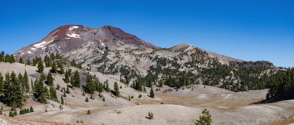
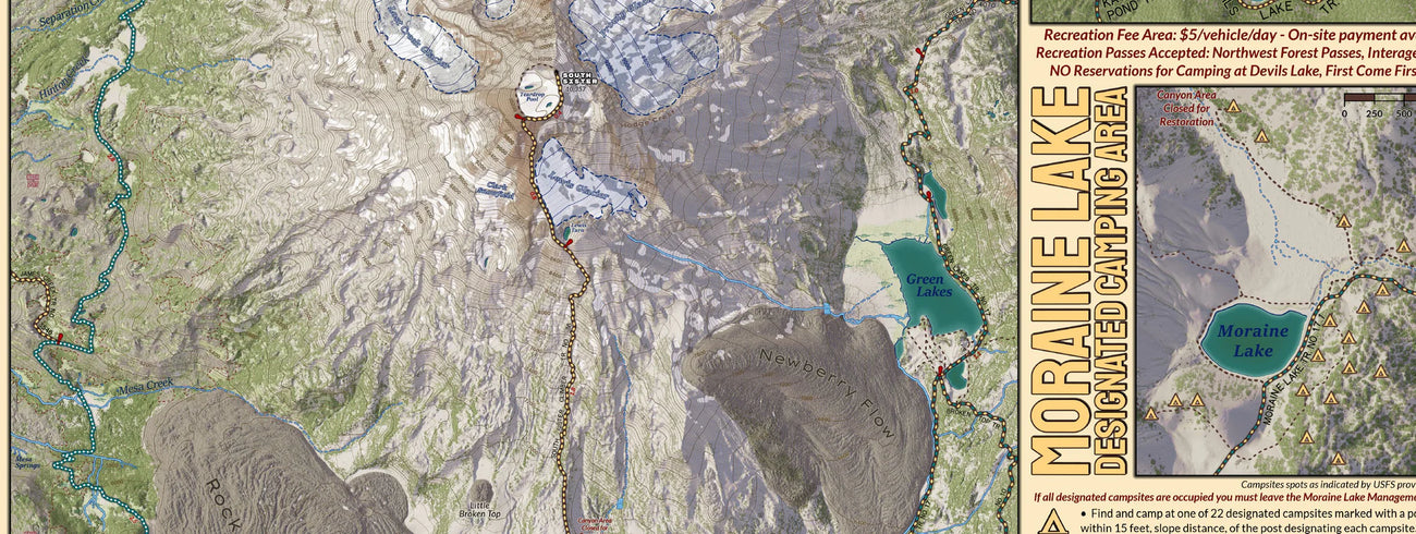
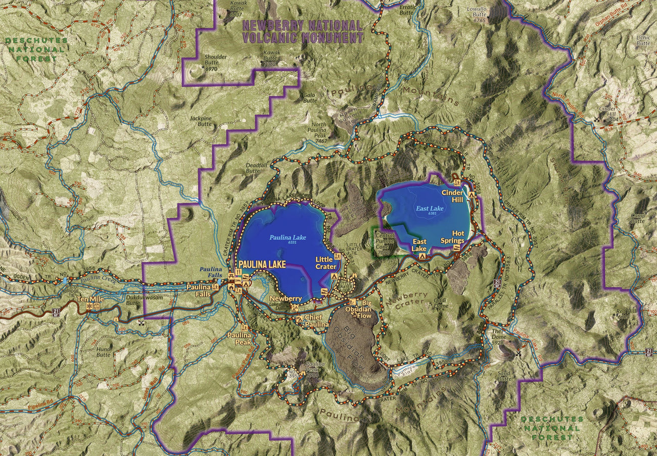
James puts his heart and soul into his map creation. “Elevation Changes Cartographic focuses on creating this type of recreational use map, especially for hikers and backpackers, displaying trails and road systems in ways that are easier to interpret and based on field observations and extensive analysis of imagery and LiDAR to create the most accurate, reliable, beautiful maps available. I spend an extensive amount of time researching the area and then exploring and recording data in the field to build more accurate datasets showing current road and trail conditions, hydrography along the trails, and features such as viewpoints, established campsites and more,” James explains. “Locating and showing a greater set of established campsites along routes can help backpackers better plan their trips and be flexible in the field, spreading out the impact of visitors by dispersing them from the limited more well-known sites that can get overused and result in environmental impacts. As our public lands become increasingly popular, modern cartography can help reduce overuse by spreading out impacts and helping hikers be confident in exploring new areas and new trails outside of the most popularized locales.”
In terms of digital maps and Avenza Maps, James used Avenza Maps to access public land agency maps, which are often available through the Avenza Map Store. “I gained more experience with Avenza Maps and its data collection and map tools in my GIS coursework, where it was highlighted as an effective and affordable toolset for collecting geospatial data and viewing maps,” he says.
“One of the features of Avenza Maps I am most excited about is the versioning feature that allows easier updates to maps,” James says. “Our landscapes are susceptible to change at an increasing rate, and every year, events like storms and wildfires can dramatically change the accessibility and safety of trails. The versioning feature of Avenza Maps can allow me to quickly change my maps in response to the effects of wildfires and extended trail or area closures.” The best part about versioning? “I can keep those using my maps far more up to date than those relying on traditional map publication schedules.”
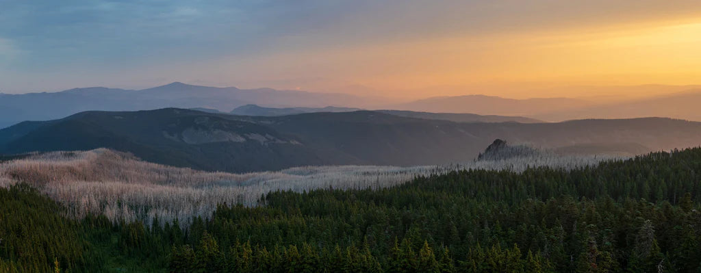
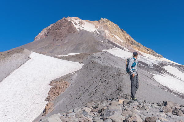
James frequently connects with users on Instagram (find them at @elevationchanges) and on his website, www.ElevationChanges.com. “I’ve connected with many backpackers planning trips on Oregon’s phenomenal Timberline Trail, my map project of which was released as my flagship product on Avenza Maps, keeping updates of the trail status and snow coverage on my website and answering questions on social media. Receiving positive feedback from backpackers that have utilized my maps and hearing them express that they helped them confidently navigate the trail systems and find great established camping has been immensely rewarding.” James provides detailed information about his hikes and beautiful photographs to show more of his adventures!
What does the future look like for James and ECC? “I have several map projects nearing completion, just requiring some on-the-ground review, but I am excited about sets of smaller, more focused maps I’m developing for Avenza Maps that focus on smaller areas, specific hikes to popular destinations, and smaller backpacking trips,” James tells us.
You can find all of Elevation Change Cartographic’s maps in the Avenza Map Store here! And be sure to check out his website to see James’ great travel tips and photography!